Today we’ll depart from Singer Island, a small portion of the Barrier Islands of the peninsular east coast surrounded by the John D. MacArthur Beach State Park north and separated from Palm Beach by the inlet that connects the intracoastal waters with the open sea in the south. The insula, which is the easternmost spot in Florida, is full of hotels, marinas and condominiums, and the standard of living is high. Sport fishing and diving are the most common activities here.
Our route starts at the Park Avenue, on which we will move north from Bamboo Street, just at the point where we will see the giant seal of the tiny town of Palm Beach Shores engraved on the pavement.
Our route starts at the Park Avenue, on which we will move north from Bamboo Street, just at the point where we will see the giant seal of the tiny town of Palm Beach Shores engraved on the pavement.
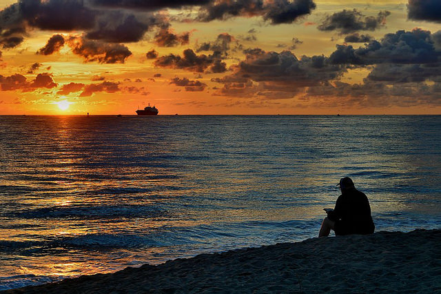
Image courtesy of Robert Pittman at Flickr.com
When we reach highway A1 / Blue Heron Blvd we’ll turn left, briefly passing through the city of Riviera Beach, as we face the high bridge that will take us to the mainland. On both sides of the street there are many shops, across the horizon we’ll see tall apartment buildings and the entire coastline of West Palm Beach and its port. From the highest point of the structure we will see countless pleasure boats of all sizes and shapes, crossing the wide waters of Lake Worth before heading out to the ocean. Right in the middle is Peanut Island, a very popular park, especially on weekends, in which thousands of people congregate.
Once we get to the US 1 / Federal Highway we’ll turn north quickly to get to Lake Park. At the US 1 there is a park dedicated to the founder -Harry Kelsey- overlooking the Intracoastal Waterway. Right in front, at the other side of the lagoon is a natural reserve with sand and coastal fruits which is what these parts looked like decades ago. Then we will be circulating in North Palm Beach. Among the points of interest which we will highlight the town hall and the Country Club with golf courses that had been originally created by Kelsey himself, formerly known as the Winter Club. The next point on the route will be Juno Ridge, home to about 740 people near Palm Beach Gardens.
On the PGA Blvd / SR 786 we’ll begin to head west, initially across a shopping area with hundreds of offices and banks. Then we’ll pass the two major highways that run through the state from north to south, the I-95 and the Turnpike as we enter PGA Commons, a modern and stylish dining and shopping district.
Soon the sights become greener and you’ll see the large and affluent residential complexes, roads and wooden bridges over the swampy areas, and huge houses and many golf courses will be visible in the background. Next is the PGA National Golf Club, the national headquarters of this sport. Having reached the C-18 canal, civilization gives way to the Loxahatchee Slough, a section of the Everglades composed of extensive pine forests, sawgrass and flooded land, rich in wildlife.
In two miles we’ll merge right at the Bee Line Road / SR 710 where the North Palm Beach County General Airport is, a civilian airport located in the endless masses of trees that dominate the landscape from now on. Then we’ll find Caloosa, a rural community devoted almost entirely to horseback riding, with more than thirty miles of tracks within it for the enjoyment of this activity. After having advanced about six kilometers we’ll see a canal and we’ll cross the road entering a dirt road closed to motor traffic. The thresher opens this part of our journey out of the asphalt and is called Halpatiokee Road in honor of a tribal leader. Once we’ve left behind the railway tracks we will be surrounded by nature, but we’ll be surprised by the wide corridors that can be seen in the forest. From the air it looks like a city, named streets, unpaved roads, delimited blocks, but without housing and in the midst of absolute nothingness.
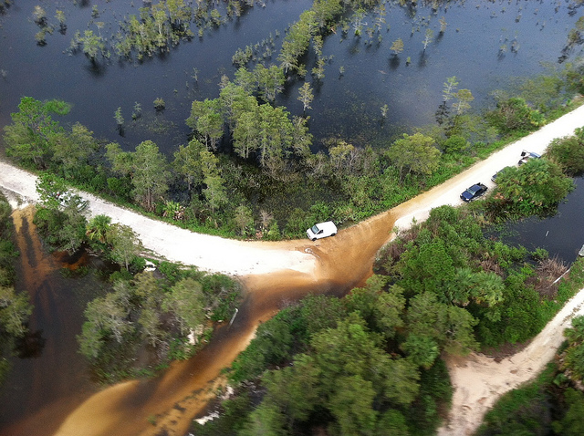
Image courtesy of Florida Fish and Wildlife at Flickr.com
This mysterious ghost city is Apix, a top secret government project that began in the late 1950s to experiment with hydrogen-based engines and to maintain the fast pace marked by the Soviet Union back then. Now you can walk these trails on foot since the passage by bicycle or on horseback is still prohibited. However, the Right-of-Way allows us to move along the canal without problems. We'll go two miles southwest and one and a half west to reach the entrance to the J.W. Corbett WMA.
This Wildlife Management Area, as all WMAs, is a natural recreational area away from any inhabited place. As soon as we arrive, we must pay for the entrance. The proceeds go directly to the maintenance of the park. Once there, we’ll advance along the main path, the Stumpers Grade. On the right we’ll find the Everglades Environmental Youth Conservation Camp, and about six miles and a half from there, among clearings, sawgrass meadows, forests, streams and lakes, we’ll get to a canal that ends the lane and at the same time, the first half of our journey. Officially, the Jones / Hungryland Wildlife Environmental Area is bordered to the north by the J.W. Corbett and annexed to Pine Glades Natural Area. To the west there’s the DuPuis Recreation Area. All this territory is part of the Florida Birding Trail, a statewide network for observing birds and an extension of the Florida National Trail, a path for walkers nationwide.
Now, to complete the route, we must go back to Palm Beach Shores. On the bike we must proceed with caution in urban areas and always be alert. If necessary, we’ll have to climb to the sidewalks. Anyway, the roads will give us enough room to roll.
Recent contents
Read Patrick Dwyer's "A bike ride through Cubitis, Moffitt, Popash, and Griffin's Corner"
 RSS Feed
