Image courtesy of Miguel Vieira at Flickr.com
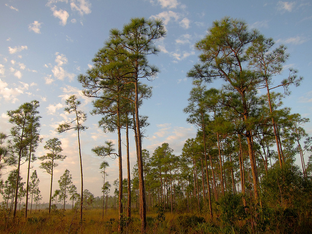
This time our bike ride begins in Everglades City, a small town of just over 500 inhabitants in the heart of the River of Glades. We’ll depart from the Ranger Station of the Everglades National Park within the village. This entrance is located on the seafront in the bay of Chokoloskee parkside of the Ten Thousand Islands at the end of the Oyster Bay Lane, next to the local airport. Here they offer boat tours through the surrounding islands. On our ride we will go north along Copeland Avenue, passing between family houses. Arriving at the central roundabout we will see some old and curious buildings like the bank, the city hall, the church or the local museum. When we leave this population the road will now be called County Road 29, and it will take us to the famous Tamiami Trail. At this crossroads is Carnestown, where we will see the chamber of commerce of the area that was built in 1966 as the first Welcome Center of the county.
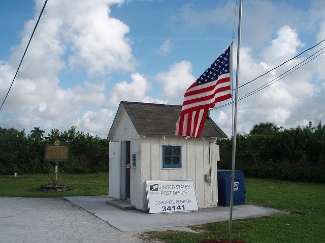
Image courtesy of itsRob_D at Flickr.com
Then comes Ochopee, as we begin to get deeper into the Big Cypress National Preserve, the huge ecological reserve of 2,910 square kilometers. This town’s name comes from the Indian dialects, and it means "great territory". It is another one of the intermediate points between the east and west coasts of Florida. The story of Ochopee is basically limited to the oral tradition of the natives, whose customs and methods of hunting and fishing have been virtually lost. Undoubtedly, the most emblematic sight is the post office, which happens to be the smallest one in the entire nation, measuring about 7x8 feet and it can be seen from the trail.
Then we continue moving eastward over the Tamiami Trail for about a mile. There we will find the Skunk Ape Research Headquarters, which is also a tourist attraction. This creature is a gigantic cryptid similar to a yeti or bigfoot and allegedly expels a strong, unpleasant odor. There is a large database includes sightings and incidents in recent years throughout the geography of the peninsula.
Then we continue moving eastward over the Tamiami Trail for about a mile. There we will find the Skunk Ape Research Headquarters, which is also a tourist attraction. This creature is a gigantic cryptid similar to a yeti or bigfoot and allegedly expels a strong, unpleasant odor. There is a large database includes sightings and incidents in recent years throughout the geography of the peninsula.
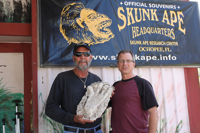
Image courtesy of Michael Lusk at Flickr.com
Continuing along the road, we keep on going for another mile and to our left, we’ll see the County Road 839 / Turner River Road, through which we’ll turn north. This street is named after the river that runs next to it and continues south to end up in the Gulf of Mexico. At this intersection we will find the H. P. Williams Roadside Park. From now and until we get back to SR 29 at the end of the route we will be going over the gravel and dirt tracks of this enormously wide and magnificent state. This is one of the largest and most spectacular Scenic Trails in the area, as it is surrounded by marshes and cypress trees in an open and spacious plain. All this territory is full of wildlife, and you can see the elusive panthers is their natural habitat. The alligators are all stacked in the water or on the banks of the canals. There are also many other tracks that are begin on both sides of the street, many of which are access to private properties and old farmland.
Seven miles into the US 41 will go westward along the Wagon Wheel Rd / CR 837 until it ends, then we will turn left. This stretch is the Birdon Road again, but this time we will be six and a half miles from the Tamiami Trail, which we passed earlier. Exactly two miles after heading south, we’ll turn right again into a new extension of the Wagon Wheel Road. Meanwhile we continue surrounded by an inhospitable environment that is tensely calm. The eternal River of Grass will be the silent company that sometimes emits squawking of birds as they see strangers approaching.
People live here and there is also a school bus stop among such desolation. This territory is home to authentic Gladesmen or men of the marshes. Already at the end of this section we will be on the confluence of this street and SR 29.
The next thing you will see in this final leg is Copeland, with a population of about 275 inhabitants, and which is accessed via the Janes Memorial Scenic Drive, another extension of CR 837. However, some of the houses are on the same road where we're going.
All we have to do now is return to Everglades City, continuing south on State Road 29. A few miles further we’ll reach the end of this spectacular route that will surely keep us entertained for about three hours. It is important to take plenty of fluids and especially sun protection. At the same time, it is essential to have an idea of where we're going to move through, considering alternative routes. We have enough space and comfort to circulate with our bike at all times, but caution is advised.
 RSS Feed
